It's a Great Day to Bird

Month: October 2018

Tennessee and Georgia (on my mind)

Tennessee (17 October to 19 October)

After doing laundry and buying groceries, we made our way to Tennessee and the Great Smoky Mountains National Park.  We decided to take Interstate-40 (I-40) for about 48 miles because we wanted to get to the park at a decent hour in order to get a campground spot.  Wow, talk about a lot of 18-wheelers on the road.  And they could only use the right hand lane of the divided four-lane highway.  And despite a 50 mph speed limit for the trucks, they were passing us when we were going between 55-60 mph.  Crazy.  I’ve never been so glad to get off an interstate highway.  We exited at Hartford, Tennessee and then pretty much traveled a number of backroads (thanks Google Maps – not) to get us to Gatlinburg, which borders one of the entrances to the park.

For the most part I like Google Maps.  What I don’t like is some of the routes they suggest to get from point A to B.  Some just don’t make sense.  And then when you do chose the route you want, that voice may later say “We found a faster route.  If you do not want to take this route, then press no, thanks” or something along that order.   I selected the route I wanted.  If I want something different, or faster, why not say “We found a faster route.  If you would like this route, please press yes.”   Are you listening Google?

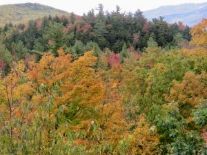
Welcome to Tennessee

If you have never been to Gatlinburg, Tennessee, then let me warn you – it’s a very touristy place, at least the downtown area.   We had stop and go traffic (not sure why), and there were hundreds of people along the sidewalks and coming out of various shops selling cheap tourist crap to expensive crap.  Lots of restaurants too.  We didn’t stop, in fact, I’m not sure anywhere to park.

Stop-n-go traffic on the main drag in Gatlinburg

The Great Smoky National Park was quite busy as well – a constant stream of traffic.  We were lucky to get a campsite in the park.  I guess this is the prime season for tourists in this part of the country – cooler, sunnier weather, the beginning of fall colors, and free park admission helps.  I wish I had known about the high traffic season.  I’m not one to visit a park when thousands of others have the same idea.  Not my idea of enjoyable.

The park was created in 1934, following the purchase of over 6,000 tracts of private land in the 1920s and 1903s, by the states of Tennessee and North Carolina as advocates for a national park.   Once a threshold of 250,000 acres was obtained then the National Park came into being.  Today the park consists of 522,000 acres, and lies in both Tennessee and North Carolina.

The plant and animal life is quite diverse.  The park is home to over 924 species of lichens. Eh gads, I didn’t know there were that many lichen species in existence, let alone in this small part of the U.S. The park also boasts over 1,500 different flowering plants, over 200 species of birds (Yay birds!!!), 60 mammals, and dozens of fish species.  And just recently, the 1,000th species unique to the park was discovered.   To top that, in the past 20 years, over 10,000 different species have been discovered in the park.  Wow!!!  This park is definitely species rich.

Since the park does not charge an entrance fee, it’s not hard to imagine why an estimated 11.0 million people visit per year.  Fall (yes now) is a popular time to visit the park.   There are nine campgrounds in the park, of which two stay open year-round: Cades Cove and Smokemont.  Some of the roads through the park are closed in the winter due to snow. Note: many roads are narrow and their winding nature makes for some white knuckle driving.

There are four visitor centers, two historic grist mills, several restored farmsteads homes with accessory buildings, and plenty of trails – but if you want to know where the trails are and a little bit about them you will need to buy a hiking guide book at one of the visitor centers or spend $1.00 for a park trail map.  There is a lot more I could say about the park, but just plan a visit here sometime.  You won’t regret it.

Our route

Cute

Donations are critical

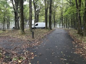
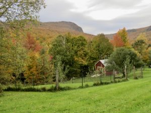
Once in the park, we drove down the Little River Road towards Cades Cove hoping to get a camping spot at the Cades Cove Campground.  No luck.  We turned around and went back to Elkmont Campground.  Luckily they had about 20 (out of 220) sites left.  We got a good one (G-25).   I talked Jack into staying here another night so we went back and had to get a different campsite for the second night, but still within the same loop (G—23), although not as nice.

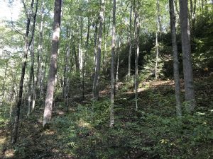
The road to Cades Cove – quite narrow
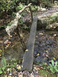
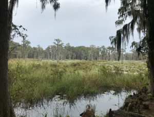
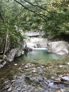
The “Little River”

Little River

This flower we’ve seen a lot in the eastern states along roadways.

Our campsite (G-25)

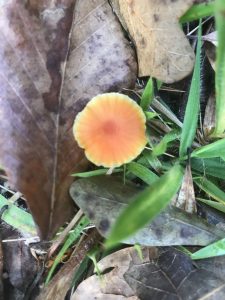
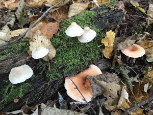
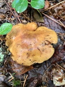
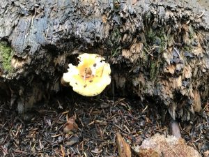
We did a quick hike of the nearby nature trail (had to find mushrooms to photograph), then came back to camp to fix dinner and retire for the evening.  Tomorrow we plan to drive Newfound Gap Road, which traverses the park in a north-south direction.

Start of the Elkmont Nature Trail

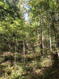
The trees here are tall. Makes bird watching difficult since the warblers seem to like the tops of the trees.

This bush is called “Dog-Hobble”. It produces purple berries.

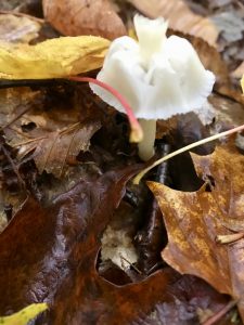
Not sure what this plant is, but cute. – small twin leaves with red berries.

One of the 900+ lichens in the park. Or are there more than one on this log? Only the lichenologists know for sure.

Interesting type of lichen

One big mushroom – my hand for size comparison.  I think this is one of the largest mushrooms we’ve seen yet.

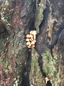
These guys on the other hand were quite small

I didn’t “pose” these mushrooms. Nice to have a top and side view of the same species.

Not sure if this is a type of fungi or lichen – I would think fungi

Spindle Coral

We left the campground around 9:00 am the next morning and headed towards the Newfound Gap Road, about five miles away.  Already the traffic was heavy.  At one trailhead – Alum Cave –  the parking lot was full and they were already parking along side the road (and this was before 9:00 am, and it doesn’t start getting light out before 7:30 am).  One the way back, I counted over 100 cars at this trailhead, and I know I probably missed at least 50 or more cars in my count.  Crazy.  A popular spot even though the trail is rated strenuous.

We drove to Clingman’s Dome where there is a short, uphill hike to an observation tower with a 360-degree panoramic view of the Great Smoky Mountains.  And what a beautiful, spectacular view.  When we arrived there were probably 30 cars in the humongous parking lot.  We parked our van in a spot to enable an easy exit and then walked the paved path to the tower.  This is not an easy hike, even though it is only ½ mile (one-way, and all uphill).  This is a very, very steep path.  I worried about some of the people walking up the path.  The tower is at 6,643 feet elevation so the hike takes some exertion beyond just its steepness.  The elevation really adds to the difficulty in hiking up from the parking lot, but the views are worth it.

When we returned to the parking lot we were amazed to find it was full of vehicles and many people were already parking their vehicle along the side of the road.  To get to the dome you take a seven-mile side road off Newfound Gap Road.  Coming down this side road, I counted over 150 cars going up.  We wonder where they all parked.  Crazy, crazy, crazy.

We continued on the main Newfound Gap Road stopping at the Mingus (grist) Mill and then the Oconaluftee Visitor Center (say that fast even once or at all), which includes a Mountain Farm Museum.  There are signs to stay out of the fields if elk are present.  Well elk were present, but people seem to think the signs don’t apply to them.  This is a pet peeve of mine.  If someone were to get attacked by an elk then they would blame the park service for their injuries, despite the signs.  People want to disobey the rules, but they don’t want to pay the consequences for their actions – whether it is injury or simply a fine.  People – take responsibility for your actions.

This photo doesn’t really show how steep this trail really is – quite steep. “Everyone” was huffing and puffing.

The walkway up to the observation tower. I guess the old tower was wooden with steps that went straight up to the top.

The observation Tower where you can get a 360 degree view of the Great Smoky Mountains National Park – I could see both Tennessee and North Carolina (which is quite easy since Clingman’s Dome is almost on the border of the two states.

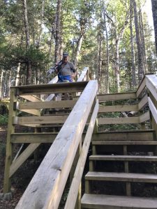
Jack on the walkway up to the top of the observation tower

View from the top

Nature Trail we took on the road down from Clingman’s Dome

This is actually a bench. I don’t think it’s been used in quite some time.

Mingus Grist Mill

Inside of the mill

Meadow Farm Museum

Yes, then even had live pigs

The one on the left was wondering if the one on the right had found something good to eat in the mud – yuck…

Now if you have a point and shoot with a zoom lens like mine then you can get the photo without having to get too close

We finished the drive and returned to our campground – no more fighting traffic and congestion.  But it was still early so we decided to hike the Little River trail near the campground.  The trail is relatively flat and wide, and parallels the Little River, which is quite a beautiful, boulder-strewn, scenic stream.  We even spotted a river otter swimming, diving, and emerging to feed while sitting on the rocks.  At one point it was bashing some food item on the rock before eating it – a crayfish perhaps?

Nice wide trail (former road) for the Little River trail

Little River

Don’t know the name of this falls, but just off the trail

Now this is a tenacious tree

Chimney from one of the old homes

When we stopped at the campground office to get our tag and sign the form agreeing to keep a bear- free campsite (no food items or odors left outdoors, subject to an $80 fine), we were told they didn’t have a record of us having reserved the site, despite our receipt showing payment.  Come to find out the ranger put in Jack’s name as “John Miles”.  That could make a difference.  Luckily we caught their mistake and got it straightened out.  The campground was full so not sure what we would have done otherwise.

The next morning we decided to drive the Cades Cove Loop Road, which was just as busy as the Newfound Gap Road.   We started out earlier on this road (about ½ hour) and had little traffic on the way to the loop road, but once there it was like all the cars just came out of the wood work (or woods…).  Again, bumper to bumper traffic.  Most people were nice and would let you out if you stopped to check out some of the historic buildings of the area.

In Tennessee vernacular “cove” essentially means a flat valley between mountains or ridges.  This was a good sized cove and in its heyday (1850s), there were 685 residents (consisting of 132 families).  We did make several stops, including several homesteads, one owned by John Oliver and another by his son Elijah Oliver.  We stopped to check out the Cable (grist) Mill at the Cades Cove visitor center.  They have interpretive panels and a person in the mill talking about how the mill was built and operated and even selling cornmeal and whole wheat.

The day started out foggy once we got to Cades Cove

John Oliver’s Home

You really don’t realize how many spider webs are out there until they are covered in dew or the sunlight hits them.  There were a lot.

The loop road through Cades Cove is one way

The Cable Mill

Cantilevered Barn

Jack liked this use of horseshoes

Elijah Oliver’s House

Jack checking out the old buildings

This barn was on the property owned by Elijah Oliver

Barn at the Cable Mill

Spring house at Elijah Oliver’s homestead. They got water here, but also kept items cold.

This is one of the old churches remaining from when the cove was occupied by homesteaders. This is a Methodist church.

A lot of the gravestones where for infants.  Many died on the same day they were born.

After leaving the loop, we headed out of the park and into Townsend, Tennessee to gas up and get a few groceries.  I ran out of coffee so we stopped at the IGA store.  I like Starbuck’s Café Verona Decaf.  The store had five different kinds of Starbuck’s coffee, none of which were Café Verona let alone Decaf Café Verona.  Will need to try a larger store.

We took the park’s Foothills Parkway and headed south.  At the end of the parkway, we turned left and shortly entered the road from hell – Highway 129!  If you get car sick (luckily I don’t), then this is NOT the road for you.  An eleven (11) mile section of road has so many turns (318 to be exact)  – first left, then right, and up  then down, and on and on and on – you got dizzy.   Some of the drop offs were quite steep and without guardrails, which added to the nerve-racking experience.  And despite the 30 mph speed limit (15 mph on the corners) there were people who wanted to go faster.  Not me.  And there must have been over 100 motorcyclists on the road.  Luckily most were coming from the opposite direction rather than on our tail.  Jack thinks the motorcyclists like the road because they can go fast on the banked curves.  We saw a lot of sports cars on the road too.  I was never so happy to get off a stretch of road as I was that one.  I did see evidence where at least two people didn’t make a turn (crosses along the roadway).  They do have pull-off areas so you can pull over and let others pass.  At five of these pull-offs there were people there with cameras taking commercial photos.  I guess if you want a photo of yourself screaming around a corner (in my case with a grimace on my face), they will sell you one.  There were two different companies:  129 Photographs and Killboys.  Oh, and we didn’t know about this road before we decided to go this way to reach our campground for the night.

We had to buy a sticker to commemorate our achievement.

We re-entered North Carolina and found a campground (Chetoah Point) in the Nantahala National Forest.  The 23-site campground has flush toilets, showers, and six electrical sites (on-line reservation required).  Not a bad little campground.  Tomorrow we headed into Georgia.

Like the sign – no spraying or mowing

View of our lake from the campsite

We didn’t really spend a lot of time in Tennessee, nor did we see much of the state.  All of the National Wildlife Refuges are located in the western portion of the state.  And since we are headed towards Florida, I decided to catch those refuges on another visit when we can also go to the sole Kentucky refuge and visit some refuges in Arkansas as well.  Ah, so many refuges yet to visit…

We woke to a very wet day.  Well, we did go three days with full on sun or mostly sunny skies so I shouldn’t complain.  We left the campground without making breakfast because our picnic table was surrounded by about an inch of water from all the rain we had during the night.  Off we went.

I took this photo when I opened our van door to step out

Georgia (20 October – 26 October)

Most of the day was spent driving.  About two hours after leaving our campsite we entered Georgia – the Peach State.  We went through the town of Helen, a Bavarian themed town with buildings and business names along that theme.  There were lots of people out celebrating Oktoberfest.  We kept going.  Jack wondered where everyone parked – maybe at their hotels???

We stayed the night at a U.S. Forest Service campground – Lake Sinclair.  We didn’t care for this campground.  Most of the camp sites weren’t level, nor well-maintained.  Of course we didn’t mind the fee – $4.50 per night senior rate.   We spent one night here.

Despite the lack of level ground, there were a lot of trees and water, and thus some good birds: Red-bellied Woodpecker, Downy Woodpecker, Pileated Woodpecker, Yellow-bellied Sapsucker, Tufted Titmouse, Carolina Chickadee, Great Blue Heron, Great Egret, Eastern Phoebe, Belted Kingfisher, Turkey Vulture, and Northern Cardinal.  I was (bird) happy.

Ruby-crowned Kinglet

Our campsite – Jack at our picnic table in the morning fixing coffee.  The picnic table was under a tree where cones kept dropping.  You almost needed a hard hat.

We visited the 35,000-acre Piedmont National Wildlife Refuges, which was established in 1939.  The refuge was about 30 miles from our campground.  I really like this refuge.  Lots of mixed hardwoods and pines.  Just beautiful.  Of course it helped it was sunny.  We hiked the 2.9 mile Red-cockaded Woodpecker Trail hoping to see one of these endangered woodpeckers, but no luck.  We have seen these woodpeckers on several occasions on previous trips, but always nice to see them again.  Despite the lack of the Red-cockaded Woodpecker, we did have some nice mixed flocks that included a family of Wood Thrushes.  None of the birds, except a Yellow-bellied Sapsucker, were very accommodating for the camera.  We did see a number of large spiders.  Luckily their webs didn’t cross the trail.  I usually walk ahead of Jack on trails because I see and hear the birds more than he does, but then I get the privilege of running into spider webs.  Luckily most of them are single threads across the trail – a bridge between two large webs???

Another refuge to add to my refuge “life” list

Sign for the Red-cockaded Woodpecker Trail

There was actually one gravestone here for a person, not a woodpecker

Red-cockaded Woodpecker nest tree

Yellow-bellied Sapsucker

Nasty looking spider

The refuge did include an auto tour route, but there wasn’t a lot of bird activity except at the very beginning – lots of Chipping Sparrows alongside the road, plus a female Northern Cardinal.  We did see a Palm Warbler on the road hawking for insects.  This little warbler likes to flick its tail so that helps in identification especially during the non-breeding season.

We left the refuge and headed to High Falls State Park for the night.  We took a wrong turn right before the park and ended up at a recycling facility.  However, we were told ONLY Monroe County residents could deposit recyclables there.  Even with no one around, the guy was very adamant about the rule, but handed us a flyer showing what could be recycled. I tried joking with him, but he took his job very seriously.  I asked him whether I should write the Governor to complain, but he mumbled that wouldn’t do much good. I guess the county would rather we contribute to their landfill?

The High Falls State Park campground has two loops – Lakeside and Riverside.  We chose the Riverside as it offers more camp sites.  We selected #37, which is located near the restrooms, but still gives us plenty of privacy.  And speaking of restrooms – you get flush toilets, HOT showers (Yay!!!), and laundry facilities.  Unfortunately, I had recently done laundry so no need for the coin-operated washer and dryer.  Each campsite has electricity and water.  Of course for all that you pay $37.45 per night.  Georgia doesn’t charge an out-of-state fee, which is nice, nor do they add on a day-use fee.

One of the “MANY” Grey Squirrels near our campground. This one was either digging something up or burying it.

Our campground site

Our next refuge to visit was the Bond Swamp National Wildlife Refuge (NWR) – another new refuge for us.  This refuge, located just south of Macon, Georgia, was established in 1989 – so a fairly new refuge.  This is a small refuge – only 6,500 acres – with several trails, but no auto route.  We walked/birded the Longleaf Pine Trail (1.9 miles).  We did get some good birds including an Eastern Towhee, Carolina Wren (gotta love those wrens), and a first for the year (FOY): Northern Mockingbird.  I would have thought we would have seen mockingbirds before now.  In some places they are actually a nuisance.  This trail wasn’t as well maintained as the Red-cockaded Trail at the Piedmont NWR.  Also, no one had been on the trail recently as there were a number of webs across the trail.  Luckily the sun was shining and we could see the webs before we ran into them.  Now these spiders were really big, so not something you want to get ‘tangled up’ with.

Longleaf Pine Trail

We weren’t quite sure what this was?

These little fungi were quite pink

Northern Mockingbird

There always seems to be an Eastern Phoebe

We saw a lot of these spiders along the trail – they’re big

While we were making our way south I luckily had internet connection.  We thought we should try and book our campground reservations for Florida.  All those snowbirds and locals might result in full campgrounds if we don’t book ahead, and it is good we did.  At two of the four campgrounds we booked there were only a couple of sites left to chose from.  One reason we prefer not to book ahead is that we like to see what a campsite looks like before we chose it – is the site level, how close are one’s neighbors.  That type of thing.  And we were hoping to spend some time camping on the Florida Keys.  No luck there.  There are three state parks on the Keys.  One is closed for reconstruction, and the other two are booked already – no space at the inn, so to speak.  We did decide to spend at least one day on the Keys and booked a beachside cottage/bungalow near Key Largo.  If we like the Keys area, then maybe we will come back sometime.

After the refuge we headed to General Coffee State Park near Valdosta, Georgia.  This is a nice little park with plenty of hiking trails.  They also have a heritage farm with goats, horses, donkeys (I love donkeys), sheep, chickens, and domestic ducks.   While I said this was a nice “little park”, it is actually good size as it was almost 1.5 miles from the park office at the entrance to our campground loop.  In Georgia they call their visitor centers/parks offices “Trading Posts”.  After setting up our campsite, we visited the heritage farm and did a short hike.

We saw this store in a small town that probably had a population of less than 1,000, and we wondered how it could stay in business

General Coffee State Park “Trading Post”

One of the “domestic” ducks

Turtle

Isn’t this donkey just the cutest, most precious thing you ever seen? I wanted to take the donkey home.

Goat

This one was hoping I had some food for it to eat. You can buy pellets, but the dispenser was empty.

Great Egret

Pond near the Heritage Far

A boardwalk we took as part of our hike in the park

Starting to get into “cypress swamp” country – Yay!!!

Cypress knees – do they support the adjacent tree or aerate the tree’s roots

Tangled vines

I like this interpretive sign about what the area may have looked like during four different periods of time

The next morning we stopped at the Banks Lake National Wildlife Refuge (another new refuge for us).  This refuge was created in 1985 and is 3,559 acres – they keep getting smaller.  Banks Lake is a natural Pocosin (wetland with deep, acidic, sandy, peat soils), believed to have been created by tidal action thousands of years ago.  The federal government purchased the land from the Nature Conservancy who bought it from the E.D. Rivers Estate in 1980.  The estate had threatened to drain the lake and harvest the cypress tree and stumps.  Go Nature Conservancy.

The refuge has a boardwalk/short trail, which we walked.  We had thought we would see waterbirds on the lake, but no luck.  In fact, there wasn’t a single bird on the lake.  Kind of eerie.  There were several people fishing, and you can rent canoes and kayaks to use on the lake.  Surprisingly, although there weren’t any birds we did find some along the trail, including a White-eyed Vireo (first of year) and one of my favorite warblers: Common Yellowthroat.  And it wasn’t easy finding these birds as the vegetation along the trail where the birds were feeding was quite thick.

Try and find birds in this vegetation

Not sure what this plant is but the Gray Catbirds like the berries

We are now in “Cotton Country”

We drove into Valdosta to get groceries and to print out an online delivery absentee ballot application form so we can have the general election absentee ballot emailed to us.  There are some important races (U. S. House of Representatives and our State legislature and Governor) and a ballot measure pertaining to salmon that we want to make sure we vote on.  Every vote counts and it is one of our rights we should not take for granted and ignore.

After Valdosta we drove to Stephen Foster State Park, which is located in the Okefenokee Swamp National Wildlife Refuge (NWR).  The 402,000 acre Okefenokee NWR was established in 1937 after the area was heavily logged.  This refuge covers 630 square miles.  That is a BIG refuge (by lower 48 standards).  In 2011 there was a fire (Honey Prairie Fire) here that burned more than 75% of the refuge and burned for over 11 months.  I do remember hearing about it at the time.  The fire was started by lightening.

The Okefenokee Swamp (actually considered a bog) is maintained by rainwater, and births two rivers:  St. Mary’s and Suwanee.  Over 354,000 acres of the 402,000- acre refuge is designated wilderness.  The refuge is also listed as a Ramsar site – a wetland of international importance.

We plan to camp at the park for two nights.  After setting up camp we did take a walk around the campground loop as we heard the loud drumming of a Pileated Woodpecker and wanted to check it out.  And as usual, there were some good birds in the campground.  We then headed towards the “Trading Post”.  We signed up to take a boat tour of the swamp the next day.  We did this same tour in 2014 on our “Big Year Adventure”.   At the boat dock ramp there was the resident alligator with a portion of its head sticking out of the water as if challenging someone to launch a canoe or kayak.

This alligator hangs out where you put in your kayaks and canoes

Near the Trading Post is a nature trail, which called out to us – “Come See What Birds Are Here”.  So off we went and we were not disappointed.  A short distance along the trail is a side trail consisting of a 2,100 feet boardwalk – well part of a 2,100 foot boardwalk.  It was near the end of the boardwalk where all the bird activity seemed to be occurring.  We had two Pileated Woodpeckers, including one drumming in an overhead tree adjacent to the boardwalk.  Great view of this magnificent bird!  There were three Gray Catbirds mewing their protest at the four Red-Shouldered Hawks in the area (I think this was a family).  We also heard a Barred Owl hooting away, and there were also several Yellow-bellied Sapsuckers and a Little Blue Heron (first of year bird for me).  When we got back to the Trading Post we heard not one, but three Barred Owls.  We tried to locate them, but no luck.  Dinner was calling so back to the campsite we went.

I like how they reuse signs for different purposes – like this nest box

Northern Mockingbird

Nature Trail

Boardwalk – side trail from nature trail

I think they may have lost a portion of the boardwalk and are beginning repairs. We could see the continuation of the boardwalk about a 100 yards beyond these boats.

More cypress knees

This Pileated Woodpecker was on a tree adjacent to the boardwalk

Pileated Woodpecker

Plenty of Gray Catbirds along the boardwalk trail

Spanish Moss, which isn’t a true moss, but rather a member of the pineapple family (bromeliad)

Brown Thrasher

Wild Turkey …

… feeding alongside the White-tailed Deer

Our campsite

After a restful night we hit the trails again starting with the Fitness Trail, which runs along the backside of the campground.  The morning birding here was fantastic.  We had 12 species in this birding ‘hot spot’, including five woodpecker species:  Pileated, Red-bellied, Yellow-bellied (sapsucker), Red-headed, and Northern Flicker.  We also had three vireo species: Blue-headed, White-eyed, and Yellow-throated, as well as numerous Gray Catbirds and Northern Cardinals.  The birds definitely like to flock together.

Fitness Trail – great birding

Pileated Woodpecker – these birds when they drum are loud. Can’t mistake it for any other woodpecker in the U.S.

Luckily no activity at this nest – it was a big nest

The Trading Post and boat launch area

From the Fitness Trail we headed back to the nature trail near the Trading Post.  We walked the entire trail today, and were happy to see a Yellow-billed Cuckoo.  We found this bird, when we heard another bird calling. If there is movement in the trees we check it out because otherwise we probably would not see many species as most are not calling or singing at this time of year (molting and not breeding so no breeding plumage or mating behavior).

Nature Trail

Beggar’s Tick Sunflower

Lots of Spanish Moss in a cypress swamp

After lunch we took our 1.5-hour park sponsored boat ride ($15.00 per person) with the park naturalist.  We did see at least 24 alligators along the slightly greater than one-mile waterway we took through the swamp.  We could see areas where the 2011 Honey Prairie Fire had burned and areas left unaffected by the fire.  And the yellow native flowering Beggar’s Tick Sunflower was prominent in these burned areas.  The seeds like to hitch-hike onto birds or insects and then disperse later by falling off the animal.  The flowers do not attract ticks, luckily.  This flower is very pretty.

Heading out a channel into the swamp

Luckily they have directional signs

We were told that this tree was almost 1,000 years old

Alligator cooling off

You can tell the length of an alligator by measuring (okay estimating because you don’t want to get “that” close) the length between its eyes and its nostrils. For instance if the distance is 10 inches, then the alligator is 10 feet in length.

It truly is an amazingly beautiful area

We flushed these two White Ibis into this tree

This Eastern Phoebe was hawking for insects over the swamp waters

I’ve never seen a phoebe clinging to the side of a tree

An adult Little Blue Heron

Anyone can put in their own boat and paddle away.  There are over 70 islands within the swamp, and luckily for boaters (motors limited to less than 10 horsepower) there are signs directing you to different parts of the refuge via water trails.  You can get a permit to camp throughout the refuge, but access is by boat only.  The only campground you can drive to is the one we are staying at: Stephen Foster State Park, operated by the state of Georgia.  The naturalist said if boaters get lost they only need to follow the flow of the water as the water exits the refuge through one of two rivers: Mary’s River or the Suwanee River.

With such a peaceful existence at the park, we decided to stay another night at the campground and visit the east side of the refuge with its visitor center and auto tour drive.  To get there we needed to drive 60+ miles.  Along the way we did see a number of hunters with dogs.  We suspect they were hunting wild boar.  An agricultural agent (we had to stop for an inspection as we enter into Florida for a short portion of the trip), said the hunters use mutt dogs because if the dogs gets gored or badly injured they just leave the dogs out there to die.  He said he has seen a number of injured dogs just wandering the roads.  We later saw a dog walking along side the road.  He didn’t look injured, but he obviously got lost or left behind.  I love dogs so I guess I have a hard time seeing them used cruelly or merely as a tool to an end.  Most of the dogs we saw were a Beagle mix.

The weather cooperated and didn’t rain on us while we were checking out the eastern portion of the refuge.  At the main entrance (near Folkston, Georgia) we stopped to pick up information, watch a movie, and a purchase a magnet at the visitor center.

This jutebox plays calls for some of the various animals found in the Okeefenokee Swamp. Cute.

The prescription bottle reads: Take 1 Forest Fire every 3 to 5 years or as needed.

Cute bench

We then drove the 7-mile Swamp Island Drive.  Along the drive we did the 0.25-mile upland trail hike (last time we were here, we saw an Eastern Screech Owl and we were hoping that four years later the tree was still there and an owl would also be at the hole – no luck with the owl, although the tree was still there).  We also stopped and toured the Chesser Homestead (learn what it is like to have lived in the area in the early 1900s), then walked the 0.75-mile boardwalk (one way – now that’s an expensive boardwalk with Trex decking and a sprinkler system to protect it from a future wildfire).  The trail leads to the 40-foot Owl’s Roost Observation Tower.  This very secure tower gives you an almost 360-degree view of the refuge.   We did see several alligators along the drive.  Back at the visitor center, we did a short hike – the Cane Pole trail that parallels the canal from the visitor center into the waters of the refuge, before heading into Folkston, Georgia for dinner.   The refuge volunteer at the Chesser Homestead told us the Thai restaurant in Folkston was very good.  We had to check it out.  Although it was good, I still like the one in New Hampshire better.

Swamp Island Drive

Water lily in a canal along side Swamp Island Drive

This is when it is nice to have a point and shoot camera with a zoom len, as my iPhone camera could not have captured this water lily very well.  I didn’t want to get too close to the canal as there could be an alligator lurking nearby.

We were told this plant was the Florida Paintbrush. The plant was at least 2-3 feet tall. Tallest paintbrush I’ve ever seen.

Artificial nest box for the Red-cockaded Woodpecker. They are seen here in the park, but we didn’t see them unfortunately.

House Wren

House Wren

Trail to the Chesser Homestead

Chesser Homestead Cabin

This little guy greeted us upon arrival at the homestead. I was even able to touch its tail.

I love this saying – “The Earth Has Music For Those Who Listen”

Blue Goose bike racks at the Boardwalk Trail

This boardwalk was quite wide. Not your typical boardwalk.

View from the Owl’s Roost Tower

View of the boardwalk from the observation tower

I love the spanish moss – so southern

This guy was along the road.  What a big alligator.

More cypress knees

Little Blue Heron near the visitor center

Little Blue Heron

Cane Pole Trail

Canal that leads out into the swamp from the visitor center

View of the “prairie” from a platform at the end of the Cane Pole Trail

If we ever return to the Okeefenokee National Wildlife Refuge for another visit we will stay longer (at the Stephens Foster State Park) and rent kayaks or a motor boat to really get out and explore the refuge.  I really hated to leave.

Next up is Florida – the Sunshine State.  I hope so.  Until then …

IT’S A GREAT DAY TO BIRD


New York to North Carolina

New York (9 October – 11 October)

New York, New York (the state, not the city).  We will avoid the city like the plague.  Way too many people and traffic.  Now if we had a small car and not the van that would be a totally different story.  I would love to bird Central Park.  We haven’t been there since 1989.   And I wasn’t a birder then.

We left Gifford Woods State Park in the wee hours of the morning – okay it was around 8:00 a.m., but no one else in the campground (our loop anyway) was stirring.  We stopped for breakfast at Sugar and Spice Restaurant on Highway 4, near the campground.  The food was good and hearty.  I had the pumpkin pancakes.  Yum!!!  The restaurant featured a lot of Vermont products (want a gallon of maple syrup?) and had a former maple distillery.

March of the Pink Flamingos

The truck had pink “Breast Cancer” ribbons

We then headed to New York, traveling down scenic Highway 22 south for most of the trip.  This part of the state is very pretty, with pastoral scenes and quaint villages, although not a lot of “fall colors”.  I guess they don’t have as many sugar maples or red maples as New England.  We eventually made our way to the 700,000 acre Catskill Forest Preserve.  We are staying for two nights at the North and South Lakes campground.  Yes, this is the site I mentioned in the last blog that has supposedly 219 campsites, although we are in campsite #218 and I sure don’t see a #219.  Maybe because they start with #0.  We are in the ‘quiet’ loop, which is located away from the lakes.  All the other loops are near North Lake.

After setting up camp we headed to the lakes (on foot) so we could hike the foot path around the two lakes.  The day was perfect – sunny, mid 70’s, slight breeze.  We couldn’t ask for a nicer afternoon.  Oh it is so, so, so nice to see the sun again.  I am a sun worshiper.  I need the sun.  When the sun shines, I feel like a million bucks.  Can’t beat that feeling.    So, the hike was about 2.5 miles in length, but we walked an extra mile as we walked to the trailhead from our campsite, about ½ mile each way.  Tomorrow we anticipate doing some more hiking around the area.

The Catskill Forest Preserve could occupy a lot of time, but we will only see a small portion of the area, although we are not in any rush as we don’t need to be in Fort Lauderdale, Florida until November 8th  – five weeks away.  The following day we catch our plane to Cuba, where we will participate in a bird survey.

Hudson River – on the Rip Van Winkle bridge

Jack at the “north” lake at North and South Lakes Campground – Catskill Forest Preserve

The fall foliage is starting to appear

Looks like fun. Something I want to try.

Trail along the north side of “South Lake”

I thought this was neat. We should have something like this in Homer.

Large Hydrangea bushes everywhere

Finally a duck in plumage that is easily recognizable – okay for you non birders this is a Mallard (drake – male)

You can see that the roots like to hang on for dear life

Trail markers to show us the way

We loved how someone saw this large rock as a type of monster and added “teeth” and an “eye”.

Here is another one – people are so creative and imaginative

American Goldfinch

There’s got to be seeds in there somewhere

Mushroom and Fungi photos for the day – some really interesting stuff out in our forests.

A type of “bear’s tooth” fungi

Our first night here we had campers close by who decided they wanted to party starting at 9:00 p.m. and ending around a little after 2:00 a.m.  They insisted on playing a boom, boom, boom, music and mixed that with alcohol.  Needless to say, I didn’t get much sleep.  So, after filing a complaint, we decided to find a new campsite in a different loop since the party group wasn’t leaving anytime soon.

After we set up in a new campsite (different loop), we were off on a 5.0-mile hike on a loop trail with views of Ashley Falls, Newman’s Ledge, Sunset Rock, and Artists Rock.  The trail was very rocky, muddy, had a lot of exposed tree roots, but stunning views at exposed rock ledges and outcroppings.  The going was slow.  One could easily get injured on this trail and not be discovered for some time since it wasn’t very busy with hikers.  Despite the treacherous trail conditions, the day for the hike was perfect – partly cloudy skies, light breeze, and temperatures in the low to mid 70’s.  At Newman’s Ledge we had some beautiful views of the Hudson River valley.

Our van in our campsite

We did encounter an interesting mix of people along the trail.  One guy said he was training to hike up Mt. Washington with his grandkids (his wife sort of rolled her eyes).  They wanted him to join them after he turns 70.  Mt. Washington in New Hampshire is notorious for it fierce weather and wind, and difficult/strenuous trails.  Funny, but you can never really tell how old people are because I would pegged this guy for being in his mid 70s at the youngest.  I wonder how old he was.  He looked a lot older than Jack, who has already passed his 70th birthday.

View of “North Lake”

Yellow-rumped Warbler

When leaves litter the trail it is sometimes difficult to see what is below – rocks, tree roots, wet soil …  Well okay maybe you can see the rocks.

Ashley’s Waterfall

Another waterfall just up from Ashley’s Waterfall

The trail goes under the rock overhang

Trail marker

Trail

View looking down from the trail

Jack climbing up the trail

One of the few bridges along the trail – it was wet and slippery

Trail signage as there were several off-shoots from the trail we were on

Yes, that is our trail – up, up, up

Yes, this is the trail too

And this …

… and here too (trail)

View of the Hudson River Valley – not much color yet

Another slate of mushrooms and fungi observed while hiking.

Well all good things must come to an end, so the saying goes, including our beautiful sunshine and blue skies.  We woke to rain.  Luckily it held off to allow us to prepare breakfast and then hit with a force just after we left the campground.  And boy did it rain – remnants of Hurricane Michael.  In some places we had to put the windshield wipers at full strength just to be able to see out the windshield.  There were flood warnings for parts of New York and Pennsylvania, but nothing in our path.

Before leaving we did have to check out Katterskill Falls in the Preserve.  Katterskill Falls is the highest in New York state.  They have a viewing platform where you can walk near the top of the falls.  You can also take a path to the foot of the first drop (the falls has two drops).  We chose not to take the path because of the rain.  We weren’t sure how safe it would be since the trail is considered steep.  We did take one of the scenic routes out of the Catskill Forest Preserve.  Very pretty, although not much fall color – yet.

Trail to the Katterskill Waterfall

Upper fall of the Katterskill Waterfall

View from the waterfall viewing platform

Pennsylvania (11 October – 13 October)

After traveling on backroads through Pennsylvania, we finally got to our campground (Locust Lake State Park) around 5:00 p.m. and made ourselves a sandwich.  Too wet outside to set up the stove and cook.

Locust Lake State Park is a large campground (277 sites), however several of the loops were closed.  The campground officially closes October 23rd.  Despite the weather – rain, and more rain in the forecast, much of the campground was booked for the weekend.   We had thought about staying here two nights, but the campground seemed so dark and dreary we decided to find another campground for the next night.

Wet, wet, wet

In various towns in Pennsylvania they have these banners commemorating hometown military personnel  that served in various wars

In the morning we were off to Hawk Mountain Sanctuary – Pennsylvania (http://www.hawkmountain.org).  This sanctuary is a well known site for raptor migration.  We hit it on a nice day (sunshine), although windy.  Along with a hundred of our closest birding buddies, we watched as raptors soared into view and overhead.  We saw a total of 11 raptor species:  Sharp-shinned Hawk, Cooper’s Hawk, Northern Harrier, Bald Eagle (loved by most people there – but not us), Turkey Vulture, Black Vulture, Osprey, American Kestrel, Merlin, Peregrine Falcon, and Red-tailed Hawk.

We spent about two hours at the North Lookout hawk watch site with its commanding view of the valley. We even had two school groups of eager children joins us.  The only birds to get real close were the vultures, and since these are big birds the kids really enjoyed watching them and got all excited.  A Black Vulture even decided to sit on a stump within spitting distance of the kids.

Eastern Phoebe near the campground

Pennsylvania countryside – on the way to Hawk Mountain Sanctuary

So how big is that raptor?  This sign shows the wingspan for each the raptors that might be seen there

This is a good primer for people – they need this as a handout

A very rocky trail. Good thing they mark the trees.

South Lookout. Not many people here. More action at the North Overlook.

North Lookout. As you can see there are a lot of people here. There were at least twice this many (and that was before the kids showed up).

A Black Vulture posing for the kids, well the adults too

Black Vulture

Mounts of the “Passenger Pigeon”, a bird that went extinct, due to overhunting, over a century ago.

Hawk Mountain Sanctuary got its start in 1934, when Rosalie Edge saw photos of hundreds of dead raptors killed by gunners.  She leased the land (1,400 acres), installed a warden and a gatekeeper, and the killings stopped.  Ms. Edge opened the sanctuary to the public and later purchased the property and deeded it to the Hawk Mountain Sanctuary Association.  This association was incorporated in 1938 as a non-profit organization and has been in operation since.  The sanctuary has since grown to 2,500 acres and now their mission is international.   Way to go Ms. Edge!  We need more people like her.

On the Hawk Mountain Sanctuary website you can get a count of the different raptor species seen during spring and fall migration (that day, total, and highest day count).  Fall migration is when most of the birds are observed.  In one day this year (September), 3,308 Broad-winged Hawks were observed.  Now wouldn’t that be fun to see.  We had a slow, but steady stream of raptors passing through.  The staff observers are amazing with their ability to see and identify what often appears to be specks in the sky.

Oh, and at the gift store, I bought a book on mushrooms of Northeastern U.S. and Eastern Canada.  Now I can go back and try and identify some of the mushrooms species I have been engrossed in photographing.  But don’t expect identification of my mushroom/fungi photos.  I still find identifying mushroom much, much more difficult than birds.

After we left the sanctuary we took the backroads to Gifford Pinchot State Park, our campground for the night.  Several things I like about Pennsylvania State Parks – no alcohol and quiet hours are from 9:00 pm – 8:00 am.  Okay maybe 8:00 am is a little late since that is when we generally leave most campgrounds.  We had a sweet campsite.  Lots of bird activity, although it was getting dark and thus hard to see the species when backlit and high in a tree.  I was able to identify American Robin, White-breasted Nuthatch, Eastern Bluebird, and Yellow-rumped Warbler.

And guess what – we woke to rain at the park.  I had thought about staying another night, but the forecast for Virginia – our next destination – was partly cloudy skies.  Rain or partly cloudy skies, well that is a no-brainer, so off we went to Virginia.

Virginia (13 October – 15 October)

To get from Pennsylvania to Virginia we actually had to go through Maryland and West Virginia.  Once in Virginia, we decided “why not take a really scenic route – the Shenandoah National Park Skyline Drive”.  So we did.  This is a 105-mile long drive along the ridge tops of the Blue Ridge Mountains.  Along this 105-mile drive there are 40 lookouts/overlooks.  We didn’t have the time to stop at all of them, but we did get in about 10 overlooks.

Since it was a Saturday, and it was nice out (although cold – 45 degrees F, with winds around 5 mph), there were a lot of people taking a weekend drive (we generally try to avoid major attractions on the weekend).  All four campgrounds were full, and most of the trail parking lots were overflowing with cars.  This drive is beautiful, especially with the sun filtering through the trees.  Surprisingly, there was very little fall color despite the peak fall foliage season being between 10 October and 25 October.

We came to this park with our friend Dave in April 2014.  At that time none of the trees were leafed out yet.  Spring climbs up the mountains at 100 feet per day, beginning in March, with trees on the ridgeline (approximate 4,000 ft. elevation) not leafing out until late May.  While the park in late April has a certain beauty of its own, it is much nicer when all the trees have leafed out.  Today the drive was gorgeous with great views of the magnificent Shenandoah Valley.

We stayed the night at a wayside area along the Blue Ridge Parkway (managed by the National Park Service) because the campground we had hoped to stay at was full (it was a Saturday night).  Hey, this way we don’t have to pay a fee.  It was actually a nice pleasant night – little traffic on the road and the wayside had a picnic table so we were able to cook.

The Shenandoah Skyline Drive leads to the Blue Ridge Parkway, which extends 469 miles along the crests of the southern Appalachians linking the Shenandoah National Park on the north, to the Great Smoky Mountain National Park on the south – what great bookends!  The Blue Ridge Parkway traverses two states – Virginia and North Carolina.  Although the parkway begins at Rockfish Gap, we didn’t start there, but rather about 15 miles to the south (after finding a full campground).

Potomac River

These are photos from the various overlooks along the Skyline Drive at Shenandoah National Park.

Our second day in Virginia, and second day on the Parkway, we only journeyed around 150 miles south.  The scenery was beautiful, when we could see it.  At times we had rain and/or heavy fog.  Kind of hard to check out the overlooks, when one can barely see the road.  And it was weird being in the fog and then suddenly popping out of it from one valley ridge (gap or hollow) to the next.  Kind of spooky in a sense.  We hope to drive another couple hundred miles on the road.

There is no commercial traffic allowed on the road (kind of like the Natchez Trace Parkway) (Yay!!! No big trucks) and traffic is light.  That might be due to the 35-45 miles per hour speed limit and lack of services (food, gas, lodging). Various exits go to towns and highway routes.  And from the parkway you can occasionally see adjacent roads used by locals and the commercial trucks.

We are staying our second night along the parkway at the Rocky Knob campground (NPS).  I was a little frantic thinking we might not get a spot since we didn’t get to the campground until around 5:00 pm. I needn’t worry as there are over 100 camping spots and probably less than 20 of them are filled.  The campground was a little eerie due to the fog.  With luck we will have a nice day tomorrow – at least no rain or fog.  One can hope.

Otter lake, dam, and creek

James River wayside

James River

This pedestrian walkway under the bridge allows access across the James River to view historic locks

The locks

Yes, we did get a little fog. Hard to see much of anything. Not fun driving in these conditions even with a slower speed limit.

Roanoake River and Falls

Our van at Rocky Knob campground

Turkey Tails Fungi – and these really did look like turkey’s tails

Well it wasn’t raining when we woke up, but the wind was blowing pretty hard (approximately 10-15 mph).  Luckily, it was a warm wind.  We continued south on the Blue Ridge Parkway, making several stops along the way for features of attraction.  The first stop was Mabry Mill.  This is an old mill site operated by E. G. Mabry from 1910-1935.  He had a sawmill, blacksmith shop, and a mill where he ground cornmeal and buckwheat (same mill as the sawmill)  He also operated a whiskey still (hidden in the woods), and had equipment to make sorghum (think molasses – similar).

Mabry Mill

Whiskey Still

Inside the mill

Waterwheel – in operation

Press for the sorghum

The pond below the mill held a domestic Muscovy duck family.  The male was snoozing, while the female was tending her brood of ten (so cute) busily feeding adjacent to the trail so a great view.  At one point, mom decided to she wanted to take the young ones across the parkway road.  Luckily the road wasn’t too busy.  She waited until she couldn’t hear a car coming and then quickly crossed with her young ones.  You might be wondering how I know she could “hear” the car coming.  Well I watched for several minutes while she tried to cross the road.   Whenever a car was near, she moved back to the grass.  So maybe she “saw” the cars, rather than “heard” them, but she did know when to go and when not to go across the road.

Domestic Muscovy (female)

The babies were soooooooooo cute

Papa Muscovy

Keeping an eye on me

We journeyed on to make a quick stop to check out the Puckett Cabin.  This cabin belonged to Orelena Puckett who became a midwife in her 50’s, and helped to deliver 1,000 babies; her last midwife delivery when she was 102 in 1939 (the year she died).  She had 24 children of her own, yet none of them survived beyond infancy. Can’t imagine having 24 births.  She got married at the tender age (maybe not then) of 16.

Puckett Cabin

Our next stop was at the Blue Ridge Music Center.  This center is a celebration of Blue Ridge mountain music and musicians (think fiddles and dulcimers).  Each day in the courtyard there are featured local musicians and today the four musicians were “The Buck Hollow Players” playing various instruments.  One of them said they were not re-enacting what happened in years past because the music still continues today.  On summer and fall weekends the Center features concerts, and fiddle contests are popular.

The Buck Hollow Players

Eastern Bluebird

North Carolina (15 October – 17 October)

Shortly after leaving the Blue Ridge Music Center we entered North Carolina, still on the Blue Ridge Parkway.  Lands adjacent to the parkway are, for the most part, privately owned.  At the beginning of the parkway (in Virginia), the Parkway passes through national forest land.  There you rarely saw a structure.  Once we began passing adjacent private lands we saw a lot more structures, although it was mostly farms with pastoral patches of green cut out of the treed landscape of the valley views.  This landscape is especially true in North Carolina.

We made several stops along the route, including at Brinegar Cabin and the Northwest Trading Post.  The Brinegar cabin was built around 1880.  They had a photo of Martin and Caroline Brinegar and Caroline looks like a friend of ours – especially the eyes.  The Northwest Trading Post offers crafts from North Carolina’s northwestern counties and China.  Yes, there were many items with “Made in China” labels.  There was a cute wooden plaque that read: Camping is spending a small fortune to live like the homeless.  I almost bought that one.

Brinegar Cabin

I laugh every time I see this

We made it to our campground – Julian Price Memorial Park.  The memorial park is the former retreat of Julian Price, an insurance executive.  This is a good size campground operated by the National Park Service.  We found a good site in loop A (site A-1), and quickly grabbed it.  After setting up camp we took a 2.7-mile hike around the lake, adjacent to our campground loop.  The trail was quite muddy, most likely from all the rain deposited by Hurricane Michael.  Oh, but I found some mushrooms and fungi, so I was happy.  Along the trail there were numerous Rhododendrons, which produce beautiful flowers in the spring.  The Rhododendrons are also common along the parkway so I bet the Parkway and this trail are gorgeous when the flowers bloom in the spring.

Price Lake at Julian Price Memorial Park

Trail

… more trail

very muddy in parts (many parts)

Jack walking around some of the really muddy parts of the trail

Song Sparrow

This deer was just off the side of the road and nothing we did could get the deer to stop feeding

There are a lot of great “overlooks/lookouts” along the parkway, allowing the traveler to see distant forested valley vistas, 3-D like mountain scenes, and pastoral settings.  The Parkway is truly a national treasure.  I highly recommend the trip.

Our final day on the Blue Ridge Parkway was foggy, rainy, sunshine outbreaks, overcast skies. – we had a little of each.  We made several stops, including two waterfalls:  Linville Falls and Crabtree Falls.  Linville Falls is named for a father and son who were killed by Indians while out “long hunting”.  Long hunting is where you are gone for 6-12 months hunting for furs.  We walked about ½ mile to the waterfalls – very nice – and then continued on to two additional overlooks of the falls.  Also very nice.  Of course we had to stop for birds along the way.  At one spot, we had 11 different species, including two warblers: Bay-breasted Warbler and a Black-throated Blue Warbler.  These birds weren’t in breeding plumage, but still great to see.  And we had another Northern Cardinal – we’ve seen so few on our travels so far.

Linville Falls trail – the beginning anyway

Linville River

Linville Falls

the gorge

lower part of the Linville Falls – after the gorge

The trail to Crabtree Falls was all down hill – so of course up hill on the way back – with lot of rocks, exposed roots, and water where several small streams decided to jump their so called banks.  The trail was 1.5 miles one way, but well worth the trip as the falls were spectacular.

Yes, this is the trail – a small part

These steps were very narrow …

… as were these

Crabtree Falls

Our final stop of the day was at the Folk Art Center near Ashville.  They had some very nice, and very expensive items.  I found a small quilt – about throw size – selling for $1,400.  I’ve never seen a quilt that expensive.   And we certainly didn’t see any “Made in China” items here.  They also had some very nice displayed items: furniture, stained glass, etc..  Unfortunately, I wasn’t allowed to take photos.

Oh and today much of the parkway today traversed national forest land so the visits were rarely marred by man-made structures.  Truly amazing views and we did start to get some color.

We decided to spend the night in Ashville.  Probably a good thing too as it was raining quite heavily outside.  Next we now make our way to Tennessee and the Great Smoky Mountains National Park.  Tennessee is the only state in the nation I have not visited.

This is a pub on wheels and you peddle. These people were laughing and having fun despite the rain – downtown Asheville North Carolina

Okay and I cannot forget today’s mushrooms and fungi.  I thought at first I wasn’t going to see much, but in one location along the Crabtree Falls trail I saw 11 different species in one small spot.  Enjoy!!!

Until next time …

It’s a Great Day to Bird

Welcome to Peeperville – Maine, New Hampshire, and Vermont

Maine (29 September – 2 October)

I’m going to try a different format and just summarize our adventures in a given state and provide photos, rather than go day-by-day.  I promise to try and not include as many mushroom photos, but there are so many different kinds of mushrooms and they do fascinate me.  I really do find them harder to identify than birds.  I thought again about buying the Peterson guide to mushrooms but I just don’t think the drawings are good enough for me to compare my photo against their drawings.

We left New Brunswick (Campobello Island) and headed to Mount Desert Island – home to the city of Bar (Bah) Harbor (Harba) and Acadia National Park.  Our designation, of course, was the park.  This is a beautiful park along the rugged Maine coast.  But it is also a very popular national park.  When we were here in June 2014 it wasn’t too busy.  This time, wow, were there ever a lot of people here.  Maybe it was because of the fall colors or maybe it was due to the three large cruise ships (which probably held at least 3,000 people each).

The park only has two campgrounds – Blackwoods and Seawall.  We stayed at the Seawall Campground.  This campground is located in a less popular part of the park – off the park driving route and the carriage trails.  Despite its location, our particular loop (Loop C) was mostly filled.  We were here for two nights.  Might have stayed longer but the campground closed on 1 October.  The other campground doesn’t accommodate RVs or vans as well.  Jack really doesn’t like the Blackwoods campground.  As I mentioned before, I don’t think the National Park Service does a good job designing campgrounds.

Before reaching Acadia National Park we stopped at Petit Manan National Wildlife Refuge – part of the Maine Coastal Islands NWR system.  We hiked the Birch Point trail – about 4.3 miles round trip.  It was a beautiful day for a hike – sunny, warm, little wind.  There weren’t many birds out – mostly Black-capped Chickadees and woodpecker or two.

Refuge Sign

Start of the trail

Traversed various habitats

On various trail mediums

Do they want us to go straight through the tree

Here they have us going in circles

Beautiful Maine coast

Hairy Woodpecker

This is an interesting creature. I hope it is not an invasive species.

I’m a lichen fan too

Another rock – “You have cat to be kitten me right meow”. That is the only type of cat that should be outdoors – cats painted on rocks.

Once at the park we did hike a portion of the carriage trails – we estimate about 3.5 miles.  These are really nice, wide trails.  When we got back to the van we found that our Yeti cooler was leaking water.  The drain plug hadn’t been turned tight enough.  The items in our suitcases were wet so we off we went to Southwest Harbor (a town on Mt. Desert Island) to find a laundromat.  We went to the Village Washtub.  Joey, the proprietor (we think he’s originally from New Jersey), was entertaining.  A very friendly guy.  Once our clothes were dry we decided to have lunch at the Little Notch Bakery – yummy pastries and pizza.  Afterwards we went to check out some of the park’s other highlights (nature center with its trails and garden), Otter Point, Sand Beach, and Thunder Hole.  Well we did stop off at the nature center and walk the Jesup Trail, but the other places were so crowded we skipped them and went back to the campground.

Looking down on a bridge for another trail – one not quite as nice to hike as the carriage roads

Carriage Road Signposts

Well it was an actual “carriage road” – so nice wide trails

Ruby-crowned Kinglet

Woodpecker tree – looks like the work of a Pileated Woodpecker

Small waterfall along the trail

Amazing how this tree can survive in all this rock – that is quite a grip for that root

Nice rock work on the bridges

Here is rock work to allow a stream to pass under the road – no culverts were in evidence

View of one of the bridges

Yes, some color

We primarily drive the backroads on our journey.  The population of Maine, according to our 2018 Road Atlas, is approximately 1.38 million people.  The largest town is Portland with approximately 67,000 people.  Wow, that means that 1.31 million people live elsewhere in the state.  After driving these backroads and passing through quaint villages we think we know where some of these people are hiding.  There are a lot of little villages that we encountered.  And a lot of homes along the road, but not part of a village.  Maybe you could say one long linear community.

I do love a lot of the distinctive homes we’ve seen here, especially along the coast – large, old homes.  Some of these homes are huge.  Would love to know the history of some of them.   And as I mentioned before there are a lot of antique stores in Maine.  A little something for everyone I guess.

This is also the lobster state.  When you look out along the coast you see a lot of floats marking the location of lobster pots.  Maine has the greatest quantity of “American” lobsters.  The lobster season is year-round, but most are caught between June and late December when the lobsters are most active.  To be harvested they need to be at least one pound.  Approximately 5,800 licenses fisherman place up to 3.0 million pots in Maine’s water each year.  A fisherman is restricted to 800 pots.  In 2017, over 110.8 million pounds of lobsters were harvested.  That is a lot of lobsters.

Speaking of lobster,  we passed a small food wagon in Wiscasset (small town along Hwy 1) and saw a long line.  I went on line and found that the food wagon is famous for its lobster rolls (no mayo added) with over a pound of lobster per roll.  The food wagon is called Red’s Eats (see: http://www.redseatsmaine.com/) and it is the #1 “Home of the Lobster Roll”, according to their website.   We didn’t stop.  Sorry, but I don’t like lobster.

We decided to stay in a hotel for a night and catch up on emails, blogs (mine), pay bills, etc., and for me – to soak in a bathtub.  I love baths.

My favorite cows – Belted Galloways (aka Oreo Cows)

Dolphin with an ice cream cone in its mouth – okay….

Colorful truck we saw in Portland Maine

A mural of a Toucan balancing two glasses of beer on its beak – Portland Maine

Invasion of the Lobster

I should have stopped in and said Hi

We are off to New Hampshire for a few days to check out the fall colors.  We hope the leaves are changing.  We had a remarkable amount of color on Mt. Desert Island, with more color it seems overnight.

But first – I’ve really gotten into taking photographs of mushrooms/fungi.  So, I’ve decided to include my mushroom photos at the end of each state’s summary.  That way, if you really don’t care about mushrooms you can just quickly by-pass these photos.

Mushrooms Seen in Maine

New Hampshire (2 October – 5 October)

Rain, rain, rain, rain, and more rain.  Despite all the rain it was beautiful out with all the fall colors.  While the trees are not quite at their peak, the multi-colored views were stunning nonetheless.  We decided to find a campground early and just veg out along Highway 113.  The campground of choice was Jigger Johnson Campground in the White Mountains National Forest.  For a Forest Service campground this campground wasn’t cheap – $24.00 a night.  Luckily we get it for half price with Jack’s Golden Age Pass.  I will admit the campground had showers and flush toilets.  Not a vault toilet to be found.   This is not typical of a lot of Forest Service campgrounds we’ve encountered in our travels.  We had a nice campsite with no adjoining neighbors.  I think most of the peepers (people out enjoying the fall color) stay in hotels.  There aren’t any lodges along Highway 113, which is a National Scenic Byway within the National Forest, but the next highway over has plenty of accommodations, including ski resorts.

Nice pamphlet given out at the White Mountain National Forest Ranger Station

Albany Covered Bridge – over the Swift River

We visited a number of the scenic outlooks and points of interest along Highway 113, including Rocky Gorge, Russell-Colbath National Historic Site (the first homestead in the area), Sabbaday Falls, Lily Pond, C.L. Graham Outlook, and Hancock Outlook.  We drove the Bear Notch Road both ways – that road had some nice scenic pullouts.  The colors along this road and Highway 113 were beautiful.  I think my favorite spot was at Lily Pond.  The colors just popped out along the road view and reflected in the pond.  And there were a lot of people looking (peeping) at the beautiful foliage as well.

Lots of campers sporting an American Flag

Inside the Russell-Colbath House

My great-grandmother had a bedspread like this.  I have a pillow with a similar pattern.

Headstone of an early settler

Trail near the Russell- Colbath House

Near Rocky Gorge  – Swift River

A bus load of tourists stopped off at Rocky Gorge to check out the falls and take photos.  Luckily one didn’t misstep and fall into the gorge.  Some got awfully close to the edge.

This trail went around a lake near the  Rocky Gorge – Lovequist Trail

Sabbaday Falls

Me on the Sabbaday Falls trail

Lily Pond

The second night we spent at Big Rock campground (another Forest Service campground).  This campground is much smaller (less campsites) and better for tent campers than for large rigs.  Plus, no showers or flush toilets – and still they charged $22.00 per night.  I wonder if this is the autumn peeper rate or the amount they charge in the summer as well.  I suspect this is their annual rate regardless of the season.

The “Big” rock for which our campground was named

There was a nice trail nearby that we walked. This is a butterfly box.

I didn’t know balsam fir was used for ice cream flavoring. I wonder what flavor(s)?

Daddy Long-leg

That is Jack’s hand next to that big leaf.

Most of the vehicles we’ve seen are from the eastern U.S. – primarily New York, New Jersey, Connecticut, and Massachusetts.  There was a splattering of other states represented, but few from the Midwest or the west coast.  I told Jack that is because residents of Montana, North Dakota, Wyoming, etc. are hunting.

We did see more warblers here than in Maine, including a Black-throated Green, Palm, Yellow-rumped, and Pine.  There was also a beautiful Blue-headed Vireo at Rocky Gorge.  This is my favorite vireo species.  Unfortunately, the birds were moving through so fast that I couldn’t get a decent photo of any of them.  Plus, they like to hang out in the upper reaches of the trees.  And these trees are tall.  One morning an American Robin was trying to take a bath in a puddle near the restrooms in the Jigger Johnson campground.  We came up to use the facilities and the bird flushed.  While inside, the bird returned.  When I came out if flushed again.  I walked off a short distance and the bird returned.  Then Jack came out and the poor bird took off again.  I wonder if it ever got its bath.  And there have always been Black-capped Chickadees.  I think without these birds we would have missed a lot of the warbler species, as the warblers aren’t calling or singing.  The chickadees like to sing – “chicka-dee-dee-dee” so we know to look up and find them.  When we do that, we generally see other bird species – warblers, kinglets, nuthatches (although they are generally quite vocal too), and vireos.  These other birds, for the most part, are silent – stealth migrators.

One more hike for the White Mountains National Forest – Lincoln Woods.  We set out under partly cloudy skies, but that soon changed to overcast skies.  At least the weather was cool enough that we didn’t sweat too much.  We hiked to the Franconia Falls – about 3.2 miles from the parking lot.  We countered a group of young people along the way with full backpacks (remote camping?).  I told Jack they could talk about how ill prepared we are if the weather changes and it started raining, or if one of us was injured somehow.  Jack was carrying one bottle of water and I had my fanny pack with my camera and bird book, and oh yeah, my wallet.  Like that would do me any good on the trail.  And no raingear between us.  At the end of the trail on one of the interpretive boards is a list of 10 essential items to bring along on a hike.  We had none.  Sad, because we know better.

Bridge to Lincoln Woods trail

The trail

Club Moss. I read where in the time of the dinosaurs, this plant was over 300 feet tall.

This rock looked like a face with the eye looking down and the mouth and chin touching the ground – sleeping our pouting?

Trail route used to be an old railway line

I like wide trails. In addition to railroad ties we did have to navigate the rocks and tree roots.

We didn’t cross this bridge, but rather walked up to the falls (trail to the left)

Franconia Falls

The “10” Essentials

After our hike we drove into the town of Lincoln New Hampshire set on getting lunch.  We were surprised at how many condos, lodges, resorts, etc. are here.  I guess this is a popular skiing area in the winter.  One resort did have a gondola running.  That would be a great way to see the fall colors.  We stopped for lunch at Thai 9.  If you love Thai food and you are ever in Lincoln, New Hampshire, check this place out.  They serve some of the best Thai food I’ve ever eaten and I’ve eaten a lot of Thai food.  Hmmm.  Maybe we should go back for dinner.  I had the yellow curry, chicken.  Yummy.

Our last night in New Hampshire was spent in another Forest Service Campground – Wildwood.  This is a small campground with only 26 campsites.  We chose #17.  The cost here is only $18.00 per night, or for us seniors $9.00.  This campground closes on October 8th (at noon).  At Acadia National Park the Seawall Campground closed our last day there.  We were told to be out of the campground by 10:00 am – that was a hard closure.  No if, ands, or buts.  Be out.

Tomorrow we head to Vermont for five nights.  We already have our reservations as not many campgrounds are open this time of year and we didn’t want to be without a camping spot.  Many closed mid-September.  Not sure why since the fall foliage is such a big deal.  Surprisingly, not many people are camping, which is good for the local motels, hotels, B&Bs, and hostels.

Mushrooms Seen in New Hampshire

I think these are called FADING SCARLET WAXY CAP

I believe this is a type of “coral” mushroom

Dacrymyces chrysospermus – a jelly fungi

Possibly “Turkey Tails”

Scaly Pholiota, I believe (poisonous – or at least some people get gastrointestinal distress)

Red Belt Fungus (???)

I know, I know.  But there have been A LOT OF MUSHROOMS.

Vermont (October 5 – October 10)

Cold this morning.  I couldn’t seem to get warm all day long.  Hope that doesn’t mean I’m getting a cold.  We made our way into Vermont, stopping for groceries in the town of Barre, Vermont.  Every town we pass through we ask each other “Could you live here?”  The answer to Barre was no.  Vermont is similar to Maine in that there are a lot of houses and villages along the road routes.  Vermont, surprisingly, has a smaller state population than Alaska.  We are #47, Vermont is #49 in state population. Guess which state is #50?

We took Highway 14 north from Barre.  This route shows scenic on the map and we weren’t disappointed.  Vermont is quite hilly, or at least what we call hills, (the Green Mountain state), and those hills were ablaze with color – reds, oranges, yellows, browns, and greens.  Beautiful, spectacular!!! The only problem – narrow roads with very few turnouts.  And I’m sure the Vermont residents aren’t happy campers this time of year when people come to enjoy the fall colors and don’t drive the speed limit, which surprisingly is only 50 mph on many roads. We pull over a lot when we can to let other vehicles pass.  Many of these back roads have lots of twists and turns (curves) so double yellow lines and no passing.  Not that those lines stop anyone from passing.  We haven’t seen a police cruiser yet on Vermont roads.

We are staying two nights at Lake Cami State Park.  We camped at this state park in 2014.  Not many people here for a Friday, and this being a long weekend (formerly Columbus Day, now Indigenous People’s Day – yeah I bet they are celebrating).  The park closes on Monday (October 8th).  We did a short hike on the park’s nature trail, even flushing two Ruffed Grouse.  And there were Yellow-rumped Warblers seemingly everywhere busily feeding alongside the trail.

We head next to Gifford Woods for three nights, however, we might not stay there the entire time.  I guess the questions becomes just how much “color” do we need to see to be satisfied?  Will have to wait and see.

Our campsite at Lake Cami State Park (Site #1)

Lake Cami

Local color

Nature trail was a mowed path adjacent to the trees

Milkweed seeds

Yellow-rumped Warbler

Black-capped Chickadee – they are everywhere

Day 2 in Vermont we hit some different back roads, and even drove through Stowe, Vermont.  Boy was that town ever busy – bumper to bumper traffic.  They were having an Arts and Craft Festival, plus the attraction of the historic village.  In fact, several towns we passed through were having some type of festival or farmer’s market.  The traffic coming into Stowe (luckily we were leaving) was unbelievable and not all of them were from Vermont.  Madness.  Again, we didn’t stop.  Not sure where we would have parked.

We stopped at a small waterfall. Nothing too spectacular (as far as drop), but nice nonetheless.  Funny how everyone seems to love waterfalls.  The parking lot, which isn’t too big, was almost full when we arrived.

Another place we stopped was the Robert Frost (poet) Interpretive Trail.  Robert Frost used to live in the nearby town of Ripton.  The interpretive trail was about a mile long.  The Forest Service did identify a few trees, but other than that nothing of the natural environment was interpreted.  There were some Robert Frost poems on plaques along the trail.  The poems were tied to the setting and one included his famous poem about the road less traveled and another his lament of miles to go before he sleeps and promises to keep.  Sorry, I’m not much into poetry.  The one I liked best was very short and about a secret.

The last stop was Costco near Burlington.  What a madhouse.  That was the worst experience I’ve ever had in a Costco.  Talk about rude, rude people.  One lady was pushing her cart down the isle at a good clip looking left and right, rather than where she was going.  I guess everyone else needed to be sure to get out of her way.  I encountered only one courteous person.   A sad commentary.

Along the way, there were some places with a lot of vibrant colors and others not so much.  There would be hillside after hillside of color, often framed with a gorgeous valley or stream.  The scenes are quite spectacular and photos really don’t capture the beauty – kind of like taking a photo of ‘our’ Kachemak Bay and the backdrop of mountains and glaciers.  Reality is so, so much better than a photo.

A number of towns we passed through were having Chicken Pot Pie dinners on Saturday night.  We thought we might stop at the nearby town (near to our campground) of Enosburg Falls to see if they were having such a dinner.  Darn, no luck.

Maple Sugar lines – the blue seemed to glow against the yellow leaves

Jack reading a Robert Frost poem

Interesting use of fire hydrants

We weren’t sure why they had these up along the highway – lots of them

Day 3 in Vermont again was more backroads for more color.   We drove over Smuggler’s Notch near Stowe Vermont.  Foggy.  Could barely see the car in front of you let alone the beautiful fall colors.  When we got to Stowe the traffic didn’t seem as bad as yesterday until we reached the main drag, then all bets were off.  Busy, busy, busy.  Once again, we continued on, although the allure of an Arts and Crafts Fair pulled at me.  I resisted.  I know if we stopped I would find something I think I couldn’t live without.  Turns out we can live without a lot of stuff in our lives.  To find out, go camping in a small van for 6+ months out of the year.

We did stop at the famous Ben and Jerry’s (B&J) ice cream factory in Waterbury, Vermont.  Madness reigned.  We stood in line for at least 20 minutes to get a dish of ice cream.  For you B&J lovers the ice cream was good, but I’ve had better.  I prefer Tillamook ice cream to B&J.  A small dish of ice cream went for $4.85 – ouch.  I could have bought a pint or more for that much at a grocery store.  But we did need to “experience” the B&J madness, although we didn’t do the tour as the line for tickets was long and the wait was over an hour.

We continued on with our foliage tour but then it started to rain and it was so foggy we decided to just veg out at the campground – Gifford Woods.  This campground is much busier than Lake Cami campground.  Both are operated by Vermont State Parks.  We did get a refund since we decided to stay here only two nights, rather than three.  Hopefully tomorrow we will have no rain, no wind, and no fog. And if the stars are aligned, sunshine.  The colors seem to “pop” out more when the sun is shining.

We did do a short hike on the Appalachian Trail that runs through the campground.  However, it was wet, rocky, and had a lot of exposed roots.  Not conducive to safe hiking so we turned around after about 1/2 mile and returned to our campsite.

Yum – their Coffee ice cream

Appalachian Trail marker – the trail ran through Gifford Woods campground

Jack on the Appalachian Trail

Trail marker

Trail was wet with lots of rocks and exposed roots – a typical New England trail

Hard to see much color with the fog

Day 4 in Vermont wasn’t much different than day 3 except for the route we took to check out the fall colors.  Before we got to Vermont I was concerned we wouldn’t have a lot of fall colors to observe.  When we passed through Vermont and New Hampshire on our way to New Brunswick, Canada the leaves hadn’t really changed at all.  While much of the foliage had turned  colors , what I didn’t count on was rain and fog.  The rain isn’t so bad, but the fog really obscures all but the immediate views.  Needless to say I didn’t get a lot of photos taken today.

We did stop off at a pottery store (D. Lasser) and checked out the beautiful, creatively designed pottery.  There were a couple of pieces I wanted to buy but that would mean either mailing them to Homer or carrying them back with us (and we still have a ways to go before returning home).  So I opted to save my money.  I could still stop by tomorrow on our way to New York and the Catskill mountains and buy a piece or two or buy it on-line.

Our campsite at Gifford Woods State Park (Site #9)

This shows you all the roads we traveled in Vermont

Didn’t really take any photos because of the fog – this is in the campground

We didn’t do much birding while in Vermont, unless we happened to be hiking.   And we didn’t do a lot of hiking.  I hope to change that as we move onward and southward.  Also, I hope to take less photos of mushrooms.  Yeah right.   Jack did by me this pocket guide of familiar North American mushroom.

Mushrooms Seen in Vermont

As I mentioned, tomorrow we had south with plans to stay at a state campground in the Catskill Mountains.  We haven’t made reservations and they are open until October 23rd so hope there will be a spot or two in their 219 site campground (7 loops – yikes!!!).  I’m sure not all the campsites will be available for use as parks generally close off a loop or two during the off-season.  I hope the sun shows itself tomorrow.  Sorely needed.

Until then …

IT’S A GREAT DAY TO BIRD


Canada Again (mostly)

19 September 2018

Where to start?  Well Ontario was a disappointment.  We took the scenic route (Highway 17E), but the scenery didn’t change much for almost 300 miles – a corridor of trees.  Pretty, but nothing dramatic.  There are a lot prettier places within the United States.

We did stop for an oil change before leaving the United States.  The oil change took about 10-15 minutes – Sweet!!!  Although I did want to work on reviewing my Minnesota/Wisconsin/Michigan blog and then posting it.  Guess it will have to wait until we return to the United States.  That may occur sooner than we anticipated.  The plan was to drive through Ontario and Quebec, heading to the Atlantic Provinces of News Brunswick, Prince Edward Island, and Nova Scotia.  When I was looking at the map today I realized that one of the places I had hoped to camp wasn’t really a campground, and once you get close to Montreal there are a million little cities, all with speed zones.  Since we don’t want to drive the interstate – to avoid all the trucks, we travel the back roads and byways.  Not that going through small towns is bad, some have an unique character, but it does lengthen the time you need for traveling – and thus cuts into birding time…

So instead we are thinking of heading down into New York, across Vermont and New Hampshire (upper portions of the states), and then into Maine before accessing the Atlantic Provinces.  We still want to visit New Brunswick, Prince Edward Island, and Nova Scotia.  And I’m thinking we should have left a couple weeks early, or planned to see the fall colors a couple weeks later.  Based on the lack of color in Ontario, we may be disappointed by the lack of color in Vermont.  Oh well.

We stopped for ice cream at “Get Lucky” (or something like that) on Trans Canada Highway 17.  A “single” cone actually had five scopes of hard ice-cream.  And the small soft serve is the largest small serving I’ve ever encountered.  They gave us the ice cream and then said, “Have a lucky day”.  Cute.  I personally like the sign near the bathroom entrance – “Men on the left, because Women are always right”.

Speaking of Highway 17.  The speed limit (when you aren’t near a community) is 90 km or about 56 miles per hour.  No one, and I mean no one, goes that speed.  I told Jack if he ever gets pulled over to tell the Mountie that he thought the speed limit signs were only suggestions since everyone passes us like we are standing still.  I suspect the Mountie would not be amused.

We are staying the night at the Samuel de Champlain Provincial Park.  The campground is strange – not very well laid out.  They do have showers so that is always a plus.  And recycling.  The cost for a non-electric site is $41.00 – ouch.  That is Canadian money however.  But remember Canadians like to charge us the same amount in U.S. dollars – $41.00.  Luckily for us they take credit cards so it should be around $32.00 instead of the $41.00.

So tomorrow, we hope to make it to upstate New York – just across the border from Ontario.  I am hoping we get there early because I would like to chill out and not drive all day long.  It really does get tiresome.

Sandhill Crane

Sign at the Lucky Restaurant about women always being right

Lake at our campground

Common Grackle

Common Grackle

20 September 2018

Well we decided to re-enter the United States in northern New York state so today was mostly a travel day – again.  Not much happened, although the first New York campground we sought out was already closed for the season.  Surprised us.  So we continued on another 100 miles or so to Cumberland Bay State Park located along the eastern shores of Lake Champlain in eastern New York near the Canadian border.  A large campground and an okay one.  Nothing special. I wouldn’t want to be here during a busy day as you wouldn’t have much privacy from your neighbors.  Tomorrow our goal is Maine, a campground near Bangor.  Once we get through our “fall colors” trip, it will be nice to go at a more leisurely pace.  I want to do more than drive.

One thing I do want to say about our travels through Ontario, there are a lot of roadside wetlands with cattails.  We also saw a lot of Canada Geese.  And yesterday we saw several large flocks of Sandhill Cranes.  One flock probably had around 150-200 cranes.  Then there was the single crane we saw.  I always wonder why a bird would be traveling alone.  Did it lose its mate?

View from our campsite at Cumberland Bay State Park

The park has a nice beach

21 September 2018

Today is another travel day – okay yes, they all are.  We left Cumberland Bay State Park under very strong winds and rain – the van is like a sail.  With such lousy weather, we decided to stop for breakfast.  Not a good day to try and heat water for coffee or make breakfast under those conditions.

The lake this morning

Can you notice the shrubs bending from the wind?

Vermont, here we come.  Since it was so windy, we by-passed Missisouoi National Wildlife Refuge.  We’ve been here before so I didn’t feel too bad about not stopping, and maybe when we come back this way in early October for the fall colors we can spend some time at the refuge.  Not sure what birds will be there at that time of year.  We took a lot of back roads, however in Vermont almost all the roads are back roads.  We did get lost a couple of times, and once almost went back into Canada.  Google maps isn’t always helpful and we didn’t always have cellphone service.  Along the way we did see several places where there was a lot of tubing within the maple trees – used for collecting and transporting the sap for maple syrup.

Tubing for collecting and transporting maple sap

After spending about four hours driving 100 miles, we finally made it in to New Hampshire.  We had less than 100 miles of New Hampshire roads to travel before entering Maine.  And guess what – the trees are barely turning colors.  Ugh!!!  We will be back in two weeks for what is supposed to be the peak of the fall colors.  A lot has to happen between now and then.  When planning the trip, I got online and found a website where you pick a date on a calendar and it will tell you (for 2018) when the colors will be peaking.  That is what I used to plan our trip.  I should go back online again and see if I get the same result.

We made it to Lake St. George State Park in Maine around 4:00 pm.  We were told all the sites were filled, although with one site, they weren’t sure if the woman who wanted the site would make it to the park or not.  So they gave it to us.  We were told this is the only weekend where campground reservations are required.

This is another strange campground.  I really wonder who designs campgrounds.  I don’t think it is anyone who actually stays in a campground.  And have you noticed that in many campgrounds the restrooms are nearest the loops with utilities – next to the people who have rigs outfitted with restrooms.  And those of us who tent camp or have vans without bathrooms have to walk the furthest to use the facilities.  This isn’t true of all campground, but many where we’ve camped.  And, Jack’s pet peeves, no coat hooks, sink shelves, and tiny shower stalls with no hooks or bench seat…okay, and a few more complaints but enough…

Our site wasn’t too bad, although we were in the open.  It was still somewhat windy, although not as bad as the campground in New York we left this morning.  And luckily no rain.  Lacking those two conditions cooking was much easier.

The reason for the full campground was because of the “Common Grounds Country Fair” in Unity, a small town nearby.  The fair is a big deal attracting an estimated 60,000 people over a three day period.  The event is put on by the Maine Organic Farmers and Gardeners Association (See: http://www.mofga.org/The-Fair).  We were told the the fair is known for its food vendors and the food is quite good.  I told a friend that two of those 60,000 individuals would not be us.  I wouldn’t have mind going except I really don’t like large crowds (parking hassles, long lines for food and restrooms), and the entry fee seemed steep – $15 for me and $10 for Jack. I don’t quite qualify for senior status yet.

Two people stopped and asked us how we like our van.  One woman had visited Alaska this past summer, including Homer.  She stayed at Seaside Farms (Mossy Kilcher’s place).  The other woman used to be a nurse in Anchorage and had visited Homer several times.  Small world.

Our van at site #2 – pretty open

Not sure what ferns these are but they are pretty – I think it is called a Sensitive Fern

Yes more mushrooms

I thought this was cute

This is for measuring a bundle of firewood the campground sells to campers.  Good use of an old plastic container.  Reuse, reuse, reuse.

Now this looks like fun

Lots of blue foam on the beach near the dock – not good for birds, not good for us

I have been finding painted rocks at several locations during our trip

22 September 2018

Today we re-enter Canada to visit the Atlantic Provinces of New Brunswick, Prince Edward Island, and Nova Scotia.  But first, a stop the Moosehorn National Wildlife Refuge in Maine, located near the Canada border.  This is a revisit, as we were here in 2014.   From a parking lot near the refuge headquarters we took the Raven trail.  Surprisingly there was some good birds – Pileated Woodpecker, Downy Woodpecker, Northern Flicker, Black and White Warbler, Blue-headed Vireo, Tennessee Warbler, Red-eyed Vireo, Yellow-rumped Warbler, Red-breasted Nuthatch, Ruby-crowned Kinglet, and Black-capped Chickadee.  A great day to bird the refuge.

Raven Trail at Moosehorn NWR

Woodpecker tree???

Some leaves are turning color

I love this

Raven Trail

One thing I noticed about Maine is they have a lot of antique shops, oh and ice-cream shops too.  Unfortunately, most of the ice cream shops are closed for the season.  I wonder if they close down after Labor Day like everything in Homer.  I really like Maine.  I think I could live here (during the spring, summer, and fall months).  But the black flies…maybe not.

The Canadian border crossing was easy – no lines.  The young man was gracious – no scowling.  He asked if we had tasers, stun guns, or weapons because they are banned in Canada.  Good for them.

We are staying at New River Beach Provincial Park.  This is a nice little park on the Bay of Fundy.  They have trails that go out to several coves, so off hiking we went.  It was nice to get some hiking in, rather than sitting in a car all day long – unfortunately,  we didn’t see much in the way of birds here.  There were some ducks on the tidal water that had me stumped.  I was trying to make a White-winged Scoters into a Common Eider.  They both look similar in their transition plumage, although the birds were starting to get that “white” tear drop shape around their eye evident in male White-winged Scoters.

New River Beach

Song Sparrow

Some beautiful views from various coves along the trail

More mushrooms. There were a lot of different mushrooms along the trail.

One of my favorite mushrooms

We saw wood carvings hanging from the trees. Don’t know anything about why they were along the trail or who put them there.

A side trail had some more “halloweenish” carvings, like this one

The trail consisted of several different mediums through various habitats

A pitcher plant of some kind

We haven’t traveled through much of News Brunswick so far, but we like what we’ve seen.  Tomorrow we are headed to Prince Edward Island for a couple of days.

23 September 2018

Brrrr was it ever cold this morning, a chilly 39 degrees F.  Quite a difference from the previous three weeks.  I think I like the night-time temperatures around 45-50 degrees for sleeping in the van.  Not so much after waking up.

We are camping at the Cavandish campground in the Prince Edward Island National Park.  The campground has 200 sites, but since this is considered the off-season, they’ve closed several loops, which means all the campers are crammed into the open loops (few or no trees).  If you are a tent camper your choices are few and you are stuck out in the open, except for about ten sites which are nestled in the trees.  All sites are really close together so you have to really like your neighbor.

Ahhhh… I just had a Red-breasted Nuthatch in the tree outside the van.  So cute.  After we found a site acceptable to yours truly (yes, I’m very picky), we decided to walk the beach.  Not too many people on the beach, which was nice because the tide was high and there were shorebirds – Sanderlings and Semipalmated Plovers – feeding along the surfline. I love watching the Sanderlings as they travel along the beach with their run, run, run, stop pattern as they follow the receding ocean waves, only to the hustle back as an incoming wave hits.  Their beaks are like sewing machines – in and out, in and out of the sand in search for food.  We did see a dead Northern Gannet on the beach, and what looked like a dead Muskrat, either that or a VERY LARGE woolly rat.  It had been partially buried in the sand and I didn’t want to pick it up and shake the sand off in order to get a better look (and photo).

We had intended to stay here two nights, but Jack isn’t thrilled about the campground.  We will explore more of the park tomorrow, and then find a Provincial park (think state parks) campground.

Okay we made a tactical error in planning out this trip in only planning for a week in the three Provinces.  I think we should have had two weeks minimum.  Something to plan for a future visit – spending more time here.  We should also include Labrador and Newfoundland.

The beach adjacent to our campground

The Barn Swallow nesting area was roped off. Dogs are not allowed on the beach all summer and into the middle of October.  On other beaches they have roped off areas for Piping Plovers.

Ring-billed Gull

Semi-palmated Plover and Sanderling

The Sem-palmated Plover (the Homer, Kachemak Bay BIrders’ Bird of the Year – 2018) likes to roost among the washed up vegetation. Great place to get out of the wind, and windy it was.

Gull footprints

Ring-billed Gull – very common

Juvenile Ring-billed Gull

Dead Northern Gannet

The Prince Edward Island National Park is known for its red cliffs. In fact the entire island has red soil (at least those areas we visited).

These two Sanderlings were roosting/loafing on these rocks, despite an occasional wave.

This is the dead animal I think is a muskrat  Use your imagination.  I mentioned it was sandy.

Sea Jelly

Unknown crab species

Northern Flicker picnicking

Blue Jay – these birds are quite raucous

24 September 2018

Brrrrrr…… It was cold again this morning (40 degrees F) and very windy (15-20 mph), but luckily the sun was out, which helps warm one when out walking/hiking.

I do want to say that Prince Edward Island National Park is poorly signed.  We even got lost exiting the campground.  The first fork in the road we took lead to a beach.  As we were driving that road there must have been at least 50 American Robins on the side of the road and these were just the birds that flushed when we drove by, even at around 15 mph.  We also saw a Northern Flicker just sitting by the side of the road.  When I looked at the bird with my binoculars I noticed it had a deformed beak.  The beak was long and de-curved.  Poor thing.  I hope it can still eat sufficiently.

Northern Flicker with a long de-curved bill – definitely deformed

The town of Cavendish, near where the campground is located, is a town that thrives on the tourists.  There were a lot of tourist related accommodations (cottages, hotels, motels, and cabins), tourist activities (miniature golf, regular golf), and eateries (lots of ice-cream stores).  Like Homer, these places close down early.  Even the campground we stayed at closes on September 30th.

Today we visited the other two segments of the Prince Edward Island National Park: Brackley-Dalvay and Greenwich.  At the Brackley-Dalvay segment we hiked the Bubbling Springs Trail (approximately 2.2 km).  We also walked the beach a short distance – very windy out.  Fun to watch the Semi-palmated Plovers and Sanderlings feeding along the shoreline.  One bird I saw reminded me of the Great Knots I saw while in Australia last year.  Maybe this bird was a Red Knot in non-breeding plumage.  I was going to get a photo of the bird when it was flushed by a gull flying low.  At one point during our walk on the beach we had around 15 Semi-palmated Plover in a small area.  Many of them were hunkered down behind rocks or seaweed trying to stay out of the fierce wind.

Nice driftwood bench

Great Blue Heron trying to stay out of the wind

Greater Black-backed Gull

Juvenile Caspian Tern

Bubbling Springs trail

Cemetery found along the trail – great place to bird

Blue Jay

Okay this is the spring. Hard to see the bubbles unless you look really, really close.

We decided to share our bench with this dragonfly.

DId you know that spotting a dragonfly symbolizes “change, transformation, adaptability, and self-realization. The change that is often referred to has its source in mental and emotional maturity and understanding the deeper meaning of life.”? (Source: https://dragonflytransitions.com/why-the-dragonfly/).

Red Squirrel – very prevalent on the island

At the Greenwich site we walked the boardwalk trail.  This is a nice boardwalk through wetlands/marsh and leading to the sand dunes/beach.  While on the boardwalk we could get within 5-10 feet of feeding Semi-palmated Plovers and Semi-palmated Sandpipers.  No Sanderlings, they prefer the beach.  We also had a single Greater Yellowleg.

Boardwalk trail through wetland

Semi-palmated Sandpiper

Trail to the beach from the boardwalk

View of the boardwalk trail from the top of the dunes

Sanderling

Yay!!! More Semi-palmated Plovers

A surfing Greater Black-backed Gull

They are cute …

Now we go searching for a nearby Provincial parks for the night.  When we were planning for the trip we thought it was interesting that the only campground open during the period we wanted to visit the island was the Cavendish campground.  I guess we forgot that little tidbit because we tried two different Provincial parks and found them both closed.  At the last one, we merely parked outside the closed gate and stayed there for the night – Site #0, cost $0.

25 September 2018

Since we weren’t at a campground last night we decided to eat breakfast at a restaurant and found one in nearby Charlottetown that was open early.  The food was okay – nothing special.  Jack, however, was just happy to have a cup of hot coffee.  The downtown area where we had breakfast is comprised of both old and new buildings.  The old buildings give the downtown area character, and there seemed to be some interesting shops – hmmmmm.  But we continued on, headed towards the Confederate Bridge, which connects Prince Edward Island with New Brunswick.

Near the bridge, was a little museum commemorating the various methods of access to the island.  The woman at the museum asked us where we were from and we said Alaska.  She asked us how we got here.  We said we drove?  She said you mean you flew and then you drove.  We said no, we drove the entire way.  She said she didn’t know there was a highway that went to Alaska.  She then asked how long it took.  It’s hard to answer that question because it wasn’t a straight shot.  We stopped and visited family and friends along the way.

Interesting traffic signals

This is the $13.0 billion dollar bridge between New Brunswick and Prince Edwards Island – 8 miles long.

Farmers are putting their hay bales in plastic wrap. Yikes, more plastic in our environment. When will it end. Do really need so much plastic?

I was very impressed with the homes and property on Prince Edward Island.  There weren’t a lot of junky properties – Alaskans know what I mean.  That changed when we got to Nova Scotia.

I checked in advance to be sure that the campground we want to stay in tonight was open.  It is, although it closes October 8th (Canadian Thanksgiving day).  We got to the campground around 2:00 pm, found our spot and then hiked the Red Head Trail, which lead us to several vistas overlooking the beautiful red cliffs.  We also got to see some great birds: Red-eyed Vireo (including a family – parents still feeding the youngsters), Downy Woodpecker, Black-capped Chickadee, Red-breasted Nuthatch, Song Sparrow, Black-throated Green Warbler, Yellow-rumped Warbler, Black-backed Woodpecker (woohoo!!!), Northern Flicker, and Ruby-crowned Kinglet.  A good afternoon to bird and hike.

Loved how the front of this house was painted

Chairs at the beach. Yes, that is Jack in the yellow chair …

… and me in the green chair

View of the lighthouse from the chairs

American Black Ducks. They look like female mallards but their bodies are darker in color.

Can’t see the name of the boat but it is the Saltwater Cowboy

These are sidewalk receptacles for recyclable materials. The proceeds from the recycled goods go to fund various charities.

View from our campsite at Five Islands Provincial Park

The start of the Red Head Trail

Eastern Chickmunk eating an apple

Downy Woodpecker

Views of the red cliffs at various viewpoints along the Red Head Trail

And just how big or small are these fungi?

Pretty good sized – that’s Jack’s hand

After our Red Head hike we walked down to the beach.  The beach here doesn’t really have any sand.  Instead it is quite rocky.  We didn’t walk far as walking was difficult with the rocks.  Along the way we encountered a large flock of American Goldfinches busily feeding on the seeds of the Canada Goldenrod.

American Goldfinch

Eastern Phoebe

View from one of the viewpoints along the trail to the beach

Trail down to the beach

As you can see the beach is quite rocky

Red cliffs viewed from the beach

This rock looks like a face to me with the eye in the middle, mouth and chin at the bottom

A very odd looking tree

A little bit of color

Herring Gull

We had a small red squirrel in our campsite that decided (okay demanded) it wanted to be fed.  Obviously other campers have fed this particular squirrel.  Jack tried chasing it off about ten times and nothing worked – it kept coming back, even came onto the picnic table.  We turned our back and it jumped up onto the picnic table, chewed through a plastic bag, and began munching on some bread.  I rewarded the squirrel’s bad behavior by giving it the ruined bread.  Guess it satisfied the squirrel since it left us alone after that.  I called it the “ninja” squirrel.

This is a nice campground with great views and I would definitely visit here again.  Tomorrow we head back to New Brunswick.  Jack wants to spend a couple of days at Campobello Island.  This island is where Franklin and Eleanor Roosevelt had a summer home.  If we didn’t have reservations at Acadia National Park (Maine) or for campgrounds in Vermont (fall colors) we would stay longer in Nova Scotia – next trip.

26 September 2018

It is wet, wet, wet, and more wet outside today.  I haven’t seen it rain like this in a long time and all day long too.  The wind was up again today, making for a not so pleasant day.  That turned out okay as we spent most of the day traveling.  First we stopped for breakfast in Parrsboro, Nova Scotia, located a short distance from our campground.  We couldn’t find any open restaurants on the main drag so we stopped at a coffee house to inquire.  We were told of two places, one in town and one a short distance from town.  Being as Jack need his hot coffee and we were both hungry we opted for the restaurant in town – the Harborview Restaurant.  Turns out we were there yesterday (it’s near the beach) where we got an $8.00 milk shake.  Yeah, kind of expensive.  Luckily that is only about $6.00 in US money – we used a credit card.

The food was good, and I would definitely eat here again.  They are only open seasonally, and they told Jack yesterday they would be closing soon for the season.  I wonder where locals or visitors go to eat for breakfast when this place closes.  Maybe the other restaurant???

I love this – the senior center next to the cemetery.

If you look at the photo from yesterday of this same area you can see  that the tide was in – quite difference, but then again it is the Bay of Fundy.

The chairs we sat in yesterday. Quite a difference in weather between the two days.  Gloomy today.

Steps up to the Pet Boutique – cute.  I might paint some on my porch.

This town is very creative. For their light posts coming into town they had sails.

More recycling receptacles

They were metal

Fence with multiple bird houses

My favorite

We took the scenic route to get to our campground for the night.  We are staying again at New River Beach (New Brunswick). We liked this campground and they give a senior discount.  They also close soon – Canada’s Thanksgiving.   Along the way we stopped at the Hopewell Cape.  This is an area with interesting “rock” formations just off the coast.  In fact, at low tide you can take a beach walk out among these rocks.  Unfortunately, the tide was high – quite high as it is a full moon, and we are at the Bay of Fundy.  Considering it was high tide, raining hard, and with blowing winds there were  surprising number of people visiting, including two tour buses.  Would be a great place to visit when it is sunny and a low, low tide.

They advertise “walk on the ocean floor” as a unique experience promoting the extreme Bay of Fundy tides.  We do that all the time in Homer Alaska, especially during an extreme low tide.  They do give talks about the tide and the guy giving the talk asked if anyone had ever been to Anchorage Alaska where they also have extreme high and low tides (30 feet was mentioned).  Anchorage is only second to the Bay of Fundy for tides, I understand.  Tidal differences in the Bay of Fundy is 38 mean feet (at Burntcoat Head, Minas Basin, Bay of Fundy, Nova Scotia).  In Homer our tide differences (low and high) can be as much as 27 feet to 28 feet.

Jack on the trail at Hopewell Cape despite the rain

Bay of Fundy on a wet, windy, foggy day

The small rock on the left is probably already under 30+ feet of water – these were named the flower pot rocks

The rest of the way to the campground was wet, windy, and foggy.

27 September 2018

Wow, did it ever rain last night!!!  Granted when the rain hits the van roof it sounds like it is raining more than if you were standing outside in the rain, but last night it was really loud, fast, and steady – woke me around 2:00 am.  Then came the thunder and lightening.  Luckily that didn’t last long, whereas it seemed to rain all night long.  I should have put out something to collect water to see how much it rained.

Luckily when we woke up later, the rain had stopped for the day.  Today we are headed to Campobello Island.  This island is located just north of Lubec, Maine.  There is a bridge to the island, or you can also take a ferry from Deer Island (New Brunswick, Canada).  So how do you get to Deer Island, you take another ferry.  So off we went to get the first ferry from New Brunswick mainland to Deer Island.  Seemed convenient since the ferry terminal was only about 20 miles or so from our campground.

Driving through the town of L’Etete, where the ferry to Deer Island is located, the garbage cans are actually boxes, although a few have the standard garbage receptacles you find in the U.S.   Some of these boxes are quite creative.  One was in the shape of a treasure chest.  One had false bird boxes (front only) attached to it, and the person’s address was on the boxes (one number for each box).

Garbage box

When we got to the ferry terminal for Deer Island we saw a sign letting us know the ferry from Deer Island to Campobello Island was not operating.  Dang.  That means we could only access Campobello Island via the bridge at Lubec, Maine.  For some reason I really wanted to take these ferries.  Oh well.  We turned around and headed to Maine.  Actually the drive was only about 100 miles.  Not bad.

We got to Lubec, Maine, around 12:00 noon.  When we crossed over the bridge to Campobello Island it was 1:00 pm.  We lost a hour traveling less than 1/8 of a mile.  I’m not sure why the Atlantic Provinces are on “Atlantic Time”.  Seems to make more sense to be on the same time zone as the eastern seaboard and Quebec.  Of course when we leave, we will gain a hour, which will be sweet.

We are staying at the Herring Cove Provincial Park for two nights.   Two nights is a rarity for us.  The campground isn’t very crowded, which is nice.  When we got to our campsite (#4), there was a mixed flock of warblers (Black and White, Northern Parula, Pine, and Yellow-rumped), sparrows (White-throated and Dark-eyed Junco), Black-capped Chickadee, Golden-crowned Kinglet, Downy Woodpecker, and Red-breasted Nuthatch flitting about.  What a treat.

The park has a number of trails and we took one to Herring Cove (you can also drive to the cove) and another leading beyond the Herring Cove to another cove.

Our campsite at Herring Cove. We thought it was weird that the fire ring was placed near the loop road.

Trail to Herring Cove – old road I suspect

Not sure what this plant is, but we’ve seen it a lot.

This is a trail we took that was located beyond Herring Cove

Semi-palmated Sandpiper

Harbor Seal

Bonaparte’s Gull

Semi-palmated Sandpiper

Ah yes, breathe …

After the short hike we went to Roosevelt International Park.  This park is the former summer home for Franklin and Eleanor Roosevelt.  At the visitor center we watched a short movie and went through the exhibits.  I thought it was well done – the exhibits anyway.  We then took a tour of the Roosevelt Cottage – ‘only’ 18 bedrooms and 6 bathrooms.  Now that is my idea of a summer cottage.  This park is the only “international” park in the world – jointly created, managed, and funded by the U.S. and Canada.

Franklin and Eleanor Roosevelt’s Summer Cottage

After visiting the Roosevelt International Park, we went to check out a couple other local spots on the island, including Friar’s Head, Mulholland Point Lighthouse, and Head Harbor Lighthouse. Both of these lighthouses are quite small.   Campobello Island itself is quite small and quaint.

View from Friar’s Head

Mulholland Lighthouse

The bridge connecting two countries – USA and Canada (Campobello Island bridge)

On the way back to the campground we stopped for a Ruff Grouse standing in the middle of the road.  Another car was approaching from the opposite direction. Luckily it too stopped.  We watched the grouse “ruffle” its feathers and posture to two other grouses on the side of the road.  After a minute or two, each of the grouses flew off into the woods.  Photos aren’t too bad considering I took them looking out the front window of the van.

And it’s a Ruff Grouse …

… strutting its stuff

28 September 2018

Woke to cloudy, misty skies this morning.  Then the rain began in earnest.  So what are we to do?  How about laundry?  We drove across the border from Campobello Island to  Machias, Maine, to do laundry as there is no Laundromat in Lubec, Maine.

Foggy this morning

It’s fun to watch the faces of construction flaggers when they see our license plate.  Their eyebrows go up in a surprise.  We mostly saw this in the Atlantic Provinces.  I suspect they don’t get a lot of travelers from Alaska, although we did see another Alaska license plate while on Prince Edward Island.

After doing laundry we drove the scenic byway (Highway 191) between East Machias and East Lubec.  Pretty area.  We stopped at a natural area and did a 2.8 mile hike (out and back), that took us to the rugged Maine coast.  Yesterday the tour guide for the Roosevelt Cottage said the best way to see Campobello Island is by taking a boat trip around the island.  I think that is true also for the Maine coast.  While you can see some of the rugged coastline by driving, I bet it is much more dramatic from the water.

This trail was very rocky with a lot of exposed roots. Made for slow going.

And some stepping stones

And boardwalk

And lots of different mushrooms

My favorite

Slug at the bottom of the photo

I know stop with the mushroom photos already

Almost stepped on this guy

Our prize at the end of the trail

This little maple sapling is in full color glory

I thought this was very cleaver and I’m going to recommend it for the outhouse at Eveline SRS near Homer

We did stop at Quoddy Head State Park.  This is still an active lighthouse, managed by the U.S. Coast Guard.   I saw a couple of lobster boats coming back to the harbor.  These boats are so different than the fishing boats in Alaska, but then we don’t have lobsters to catch.

Quoddy Lighthouse

Lobster boat returning home

Tomorrow we head to Acadia National Park in Maine.  Our farewell to Canada until we return home via western Canada next Spring.  But, remember…..

IT’S A GREAT DAY TO BIRD


© 2024 alaskabirder

Theme by Anders NorenUp ↑